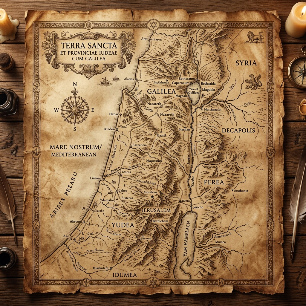
When we read the New Testament, it is incredibly easy to treat the locations mentioned—Galilee, Samaria, Judea, and the Sea of Galilee—as merely backdrop scenery for the theological action. But in the ancient world, geography was destiny. The physical terrain, the climate, and the regional borders dictated economics, culture, and politics. To truly understand the ministry of Jesus, we have to understand the ground he walked on.
The North vs. The South: Galilee and Judea
The cultural divide between Galilee in the north and Judea in the south was arguably as vast as any modern political divide. Judea, anchored by Jerusalem, was the religious and academic epicenter of the Jewish world. It was arid, rocky, and dominated by the Sadducean elite and the massive Temple complex. Judeans often viewed themselves as the pure, sophisticated center of biblical orthodoxy.
In stark contrast, Galilee was lush, fertile, and overwhelmingly agrarian. It was known as "Galilee of the Gentiles" because it was surrounded by Hellenistic cities and heavily influenced by international trade routes. The Judean elite viewed Galileans as rustic, uneducated peasants with a funny accent. This is exactly why Nathanael infamously asked, "Can anything good come out of Nazareth?" (John 1:46). Jesus purposefully chose to launch his ministry and select his disciples from this despised, blue-collar region, immediately setting himself at odds with the Jerusalem establishment.
The Barrier of Samaria
Between Galilee in the north and Judea in the south lay the region of Samaria. The geographical positioning of Samaria was a logistical nightmare for Jewish pilgrims. Due to centuries of deep-seated ethnic and religious hatred, orthodox Jews traveling from Galilee to Jerusalem for the festivals would literally cross the Jordan River to avoid setting foot on Samaritan soil, turning a simple three-day journey into a grueling, dangerous week-long trek.
When the Gospel of John states that Jesus "had to go through Samaria" (John 4:4), it was not a geographical necessity; it was a theological provocation. By sitting at Jacob's well and speaking with a Samaritan woman, Jesus was deliberately dismantling hundreds of years of geopolitical and ethnic hostility, demonstrating that the Kingdom of God would not respect human borders.
The Highway of the Sea of Galilee
The Sea of Galilee (actually a large freshwater lake) was the economic engine of the northern region. It supported a thriving fishing industry and served as a major aquatic highway. Because the lake sits nearly 700 feet below sea level and is surrounded by steep hills, cold air from the mountains frequently rushes down into the warm basin, causing violent, unexpected squalls to erupt practically out of nowhere.
Understanding this topography explains the sheer terror of seasoned fishermen when a storm struck their boat (Mark 4:37), as well as the magnitude of Jesus calming the wind and the waves. The lake also provided a natural amphitheater; Jesus frequently taught from a boat pushed slightly offshore, using the water to amplify his voice to the massive crowds gathered on the sloping hillsides.
Geography as Theology
The parables of Jesus are deeply rooted in this specific geography. When he spoke of the man who went "down from Jerusalem to Jericho" in the parable of the Good Samaritan, his audience instantly pictured the notorious, 18-mile, winding desert road plagued by bandits. When he spoke of building a house on the rock instead of sand, he was referencing the dry wadis that looked safe in the summer but turned into raging flash floods during the winter rains.
By understanding the physical landscape of the Gospels, the text ceases to be a collection of abstract spiritual principles. It becomes a gritty, historical reality where the Son of God engaged the world exactly as it was.